
Southeast
Border Route Map - Start: Sagonto at Red Pine Island (red star)
to Cache Bay Ranger Station (upper right red box) to Prairie
Portage Ranger Station (lower left red box) - an estimated 32 miles)
|

Day
#1: Leave Sagonto dock: 5:08 am, arrive at
Cache Bay Ranger Station 7:20am
Ranger Janice gives a route briefing, depart 9am
(green = outbound - red = return) |
 |
|
|
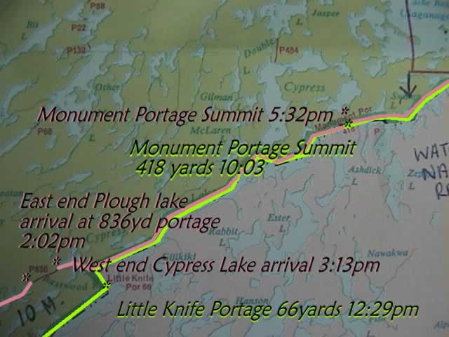
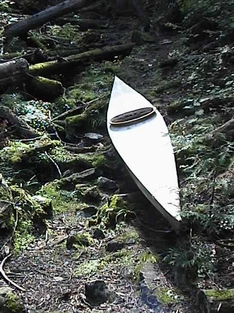
Day
#1: Trouble finding 264yd. Portage from Carp L. to Birch L.
After numerous rapids and a couple carryovers, portages were
getting "old", so I believed that I had crossed over P264
already.
Where the green line forks to the south is where I was searching for
the channel that did not exist. I was never so glad in my life to
come across that last portage!
With thoughts going through my mind of being lost
and not seeing a soul for miles of wilderness,
I
almost camped at this point since it was becoming dark.
Then, discovering the small falls around a hidden point,
I had renewed stamina to plod onward.
Note: No pictures were taken since the break on Knife
till the arrival at Prairie Portage for sake of time.
|
|

Top: 7:20am
- arrival
at Cache Bay Ranger Station
Bottom: 10:03 summit of Monument Portage, 418 yards
|

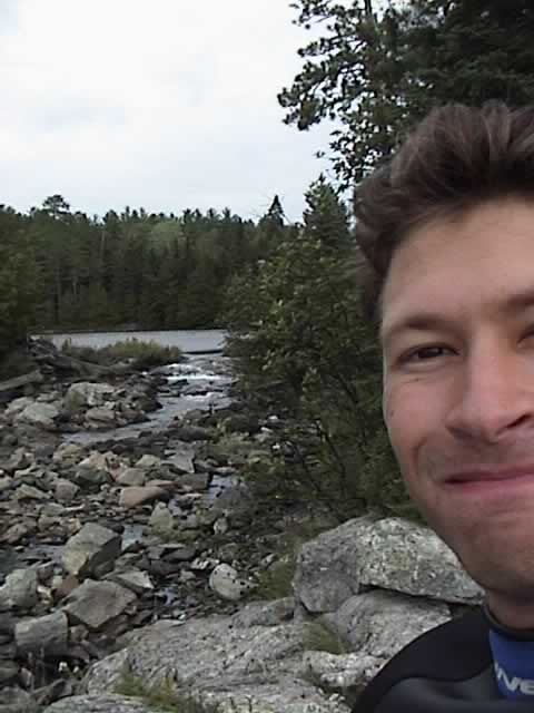
Day
#1: Yours truly, Marco Manzo III with Mr. Burdick,
Ottertrack (Cypress) Lake, after crossing Monument Portage |
|
Day
#1: 12:29pm - Little Knife Portage - Cypress Lake in background
|
|
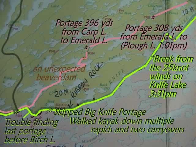
Top
left: Day #1 - 3:31pm - 1/3 way down Knife lake - break from
25knot winds - thoughts of turning back - fatigue setting in and just
a little depressed about the lack of progress and slow moving shore.
An hour later I gathered the gear together after a snack and
rest and
departed into the face of the wind, having to paddle
twice as hard as before to make any headway.
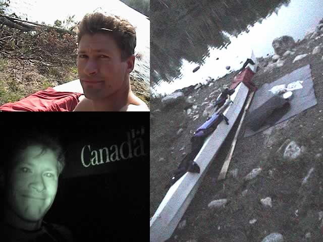
Bottom Left: Day #1 - arrival at Prairie Portage 8:55 pm
Right: Day #2 6:14 am - Prairie Portage, sleeping mats,
clothes drying on kayak, Birch Lake (photo brightness and
contrast adjusted for viewability).
|
|
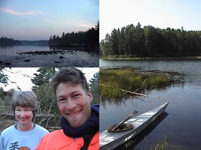
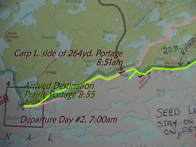
Top
left: Day
#2: 6:29 am, Basswood Lake, ranger station to right
Bottom left: 6:40 am, Andrea Allison, Friends of Quetico House
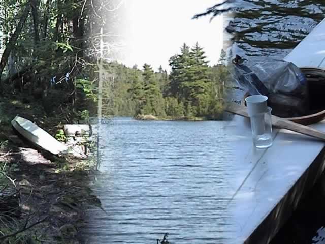
Right: 10:50am Carp Lake Portage
to Emerald Lake
crossed an unexpected beaver dam around corner to left
|
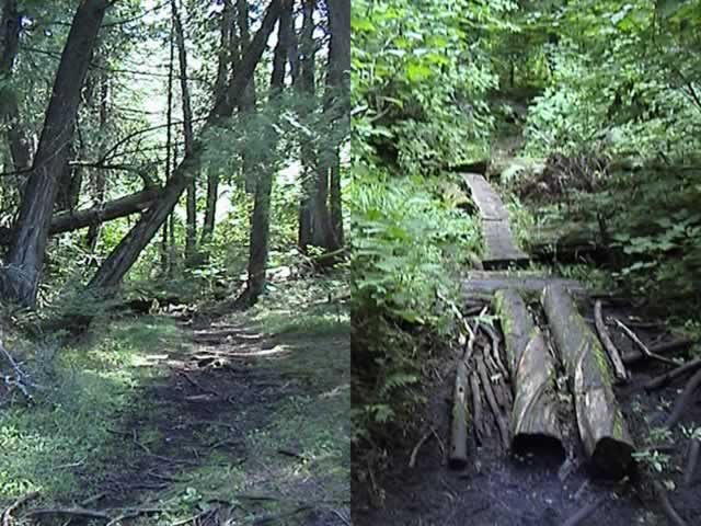
Day
#2: 836 yard portage, from dry-roots to mud and corduroy swamp |
|

Day
#2: 836 yard portage - Center: Unidentified
low-growth seed pod on stem with broad, green leaves.
Please contact us by email if you can I.D. this plant.
Thanks
to Shirley Peruniak and Ron Lawrenz
this
plant has been identified!
Nodding
Trillium (Trillium cernuum)
"Earlier in the year the flower would have had three white sepals
and the flower nods down (thus the common name).
It is in the lily family and thus has three parted divisions,
or multiples thereof. Three leaves in whorls,
sepals in arrangements of three to form the flower,
and three little beaks on the end of the fruit or seed pod.
That Nodding Trillium has a red fruit is further evidence [of this positive
ID].
Most people don't get to see the fruits because they appear in the fall.
"
-
Ron Lawrenz
I have been asked what this "fruit" tasted like.
Please note: I am not in the habit of picking wildflowers!
and I do hope that other visitors of this long portage will
enjoy seeing this plant, as I have left it be. And I implore all that
visit the Quetico and surrounding wilderness, will observe this
practice and leave this and other plants be, for the enjoyment of all.
Picking just one wildflower does make an impact
- if multiplied or not by every person that picks just one.
|
|
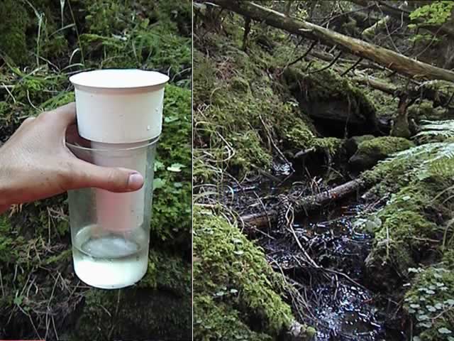
Day
#2: Exhausted, and unsure how much more of the 836 yards
to go till I reach Cypress Lake, I find a small brook to the south,
and stop to wash the mud from my feet and sandals.
Then, taking the Britta, I filled the reservoir from
the brook's small trickle, and discovered that the
water had frosted the plastic. Very refreshing!
|
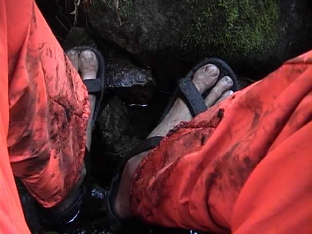
muddy feet washed in brook |
|
A
break halfway across the 836 yard portage
from Plough L. to Cypress L. Tough going
over uneven terrain. It seems that this is
the portage less traveled, but yet is still
traveled as I discover fresh shoeprints in the mud.
|
Left: Blue
spotted through trees! End
in sight!
Center: Cypress Lake
Right: Quick drink of the water of Cypress |
|

Red
Dragonfly - Monument Portage Day #2 5:10 pm
|
|

Day
#2: Arrival at Monument after crossing Cypress L. 5:06, break for snack
Arrival at summit: 5:41
5:49 - Crossing from Cypress L. to Swamp L. complete
|
|
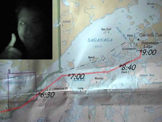
6:30 Radio Sagonto by Handheld, no response:
Contact with Coop, a cabin owner.
7:00 15 knot southeast wind picks up.
8:40 Radio contact with Sagonto, Dinna Madsen,
My Grandma and owner of Sagonto
Inset:
9:00 pm - Arrival at destination: Sagonto!
|
| |
| |


